
XMission Multifunctional UAS, XAG
Brand: XAG
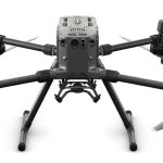
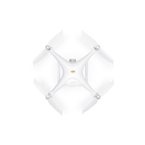
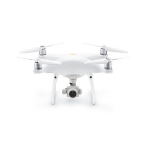
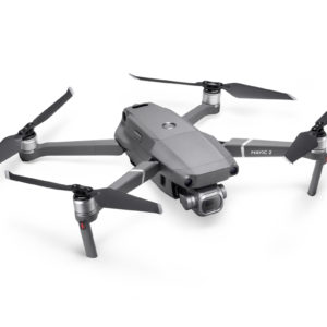
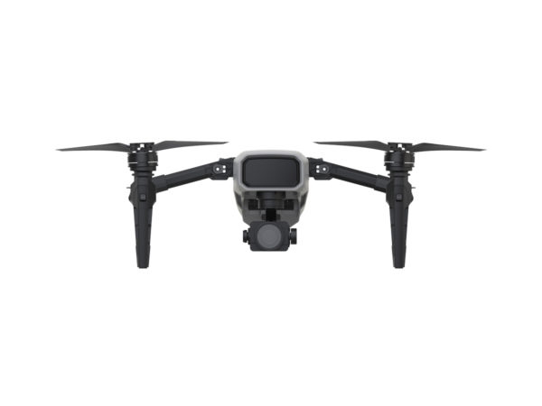
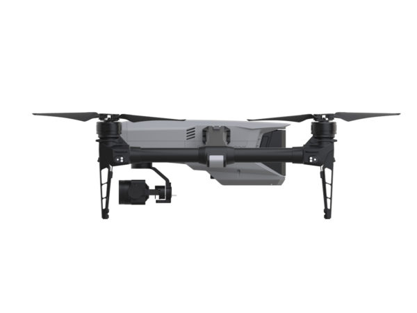
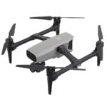
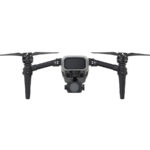
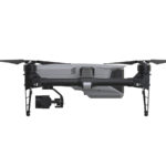
Building on a wealth of cutting-edge expertise and proven innovations, XAG XMission is an industrial level multifunctional Unmanned Aerial System (UAS). Sophisticated design and state-of-the-art manufacturing process lay the foundation for a light, portable and powerful drone platform, ready to use right out of the box.
The SUPERX3 PRO RTK flight control system provides XMission with centimeter-level navigation for fully autonomous flights in various control schemes and allows third-party payloads to meet specific demands of different applications
Για πληροφορίες πατήστε παρακάτω
- Περιγραφή
- AIRFRAME
- FLIGHT PARAMETERS
- GNSS
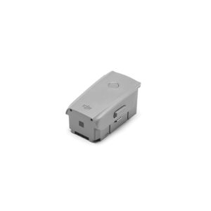
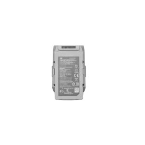
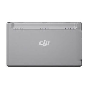
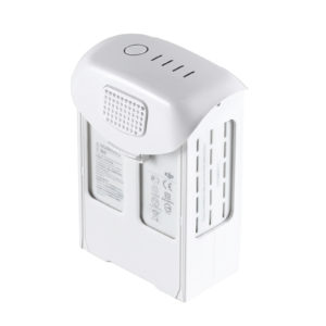
- BATTERY
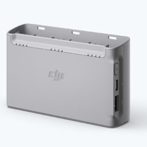
- BATTERY CHARGER
- TERRAIN FOLLOWING
- RGB CAMERA
- COLOR IMAGE SENSOR
- MULTISPECTRAL CAMERA
Περιγραφή
The SUPERX3 PRO RTK flight control system provides XMission with centimeter-level navigation for fully autonomous flights in various control schemes and allows third-party payloads to meet specific demands of different applications
Light & Foldable
RTK Precise
Positioning
Fully Autonomous
Flight
Open SDK
LIGHT, HANDY, RESPONSIVE
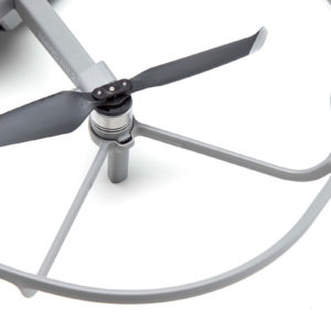
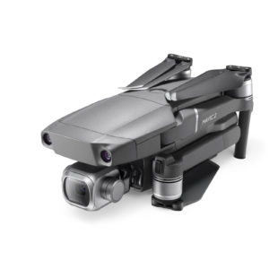
Aviation-grade carbon fibre and magnesium aluminium alloy ensure the lightweight and portability of foldable XMission. It can be deployed immediately with a flick to unfold.
A RELIABLE PARTNER TO WORK WITH
The intelligent SUPERX 3 PRO RTK flight control system is the 5th generation of XAG’s patented industrial application avionics system. Powerful computing capabilities and reliable safety configurations are combined to provide support for autonomous flight, with superior reliability and redundancy.
Flight safety is further guaranteed with a terrain-tracing radar effective within 100 meters, and a front obstacle avoidance system intended to scan terrain and detect obstacles.
FOC Vector
ESC
Fleet
Mode
100 m Terrain Tracing
3xIMU
AI Fault Prediction
UPS
FailSafe
Protection
Obstacle
Avoidance

FLEXIBLE PLANNING,
EASY TO CONTROL
A variety of flight modes facilitate XMission to tackle challenging landscapes, including standard pattern, grid pattern and linear pattern, and to adjust itself to multiple mission scenarios. All operations can be completed by a smartphone and the add-on ACB1 CommBack.
You can select target fields, adjust flight and imaging parameters directly within the App. Autonomous missions like surveying or inspection can be conducted with ease after a small amount of training.
GRID PATTERN
Polygon, Enclosed Area

DOUBLE GRID PATTERN
High Definition 3D Modelling

LINEAR PATTERN
Architecture Inspection
CENTIMETRE-LEVEL POSITIONING, BUILT FOR PRECISION TASKS
Dual RTK plus GNSS positioning system, and real-time centimetre-level flight positioning provides reliable data support in various air tasks. XMission carries a 4G communication module connected to the XAG Cloud RTK network to immediately start missions without setting up Portable RTK Base.
Dual-engine RTK
All 4G Networks
2.4G/5.8G HDLS
MESH Networking
THIRD-PARTY PAYLOAD FOR MULTIPLE NEEDS
With 3 digital extension interfaces and an open SDK, the payload system can be customized or developed with the freedom to meet the requirements of industrial users. XAG XCam Imaging Camera and XAG XCam MultiSpectrum Camera help with fast farm information collection and decision-making.
XAG® XCAM® IMAGING CAMERA
Reliable Solution to HD Imagery
With XAG XCam, centimetre-level accurate imaging and mapping can be accomplished with ease. Both cloud and local image stitching solutions are available to generate 1:500 HD-maps.
Farmland boundaries can be mapped by XAI Agriculture Intelligence and then would be applied directly to the XAG P series UAS for autonomous plant protection operation.
1-inch CMOS
Global Shutter
M-second Sync
Distortion Correction
Auto Focus
Auto Focus
The 1-inch 20-megapixel CMOS sensor produces high-resolution images. With global shutter, sharp images can be captured without distortion or blurring even during high-speed flights.
Meanwhile, the XCam can precisely coordinate and synchronize data in milliseconds, which ensures imaging is consistent with its time and geographical location, so as to meet the requirements of 1:500 HD mapping.High-definition imaging is further secured by optical autofocus and pre-setting distortion data of lens to facilitate post stitch processing. With the terrain-tracing module of XMission, XCam can conduct 3D terrain modeling for complex environments and fly in grid patterns, tracking terrain fluctuations to ensure consistent resolution of the overall model.
CLOUD + LOCAL IMAGE STITCHING SOLUTIONS TO MEET DIFFERENT DEMANDS IN DIFFERENT SCENARIOS.

XCAM + ENCRYPTED CLOUD COMPUTING:
High-speed processing for large scale mapping data, 15 minutes for 200mu (13.3ha).

XCAM + XSTATION:
Quick on-site processing without network, 15 minutes for 200mu (13.3ha).

XCAM + MOBILE APP:
Suitable for small land data processed directly by mobile phone, 3 minutes for 20mu (1.3ha)
Farmland boundaries and crop positions in 2D/3D HD maps can be mapped by the XAI Agriculture Intelligence and then would be applied directly to the XAG P series UAS for autonomous plant protection operation.

XAG® XCAM® MULTISPECTRUM
Remote Sensing to Facilitate Precise Decision-making
With XCam MultiSpectrum camera, 4-spectrum HD crop images can be captured as well as HD RGB images. The NDVI map aligned in pixel level can facilitate on-site agriculture decision making. The farm prescription map generated by XAI can be applied directly to the XAG P series UAS for autonomous plant protection operation.
Equipped with an 1-inch 20-megapixel RGB camera + a four-spectral channel high-sensitivity CMOS sensor, the system can capture 4-band HD multi-spectral images of crops and HD RGB (visible light) images. The global shutter can precisely coordinate with RTK navigation to synchronize images with the high-precision position data in milliseconds. The images from five different channels are aligned automatically, and the photosensitivity sensor is calibrated automatically. Accurate remote sensing image of farmland can be processed on-site, what you get is more than what you see.
Multi-Spectrum + RGB
Global Shutter
M-second Sync
Distortion Correction
Auto Focus
Auto Alignment
Auto Sensor Calibration
One-site Processing

If any abnormality is found on the farmland during shooting at high altitude, XMission will react as a “microscope” and perform a supplemental shooting for the abnormal area at lower altitude. Meanwhile, multi-spectral and RGB images of the area will be processed simultaneously to assist decision-making.
The AI digital farmland model generated by XAG Agriculture Intelligence will provide crop spraying prescriptions directly applied to the XAG P Series Plant Protection UAS, achieving the goal of “spray only where it needs” for farmers.

To cope with more challenges, XAG will allow third party payload and communication protocols on XMission. By doing so, developers can create more possibilities to meet the demands of various industries by utilising the open SDK and development documentation

Consumer Policy – Unauthorized XAG Dealers
To ensure the highest quality of XAG Products, including XP2020, XMission, and R150. XAG is dedicated to providing the best customer support through a trusted network of authorized distributors and dealers, and strongly advises the customer to purchase from the local authorized distributor and to be aware of the possible risks that may result from purchasing products outside the countries where it is originally sold or through unverified dealers.
There are unauthorized dealers that advertise and sell XAG products. These products may be deactivated and not operatable. XAG cannot guarantee the quality or effectiveness of such products and as such, these products are not covered by XAG’s warranty.
Please note that unauthorized sellers may appear on a marketplace site, hosted by companies such as Alibaba, Amazon, eBay, and similar marketplaces. When purchasing on these marketplace sites, you should always confirm that the reseller is an authorized XAG dealer.
It is your responsibility as a customer to ensure that the retailer you purchase from is an authorized XAG dealer. To verify that a dealer is authorized, please contact for information.
| Dimensions | 682 x 682 x 170.5mm (Unfolded) |
| Weight (Battery & Propellers Included) | 2.25 KG |
| Diagonal Size (Propellers excluded) | 492mm |
| Max Ascent Speed | A Mode: 6m/s |
| M Mode: 4m/s | |
| Max Descent Speed | A Mode: 3m/s |
| M Mode: 3m/s | |
| Max Speed | 57.6 kph |
| Max Tilt Angle | 35° |
| Max Angular Speed | 150°/s |
| Max Service Ceiling Above Sea Level | 19685 feet (6000m) |
| Max Flight Time | 35min (Max) |
| Operating Temperature Range | -20° to 40°C |
| Operating Frequency | 2.400 ~ 2.483GHz |
| 5.725 ~ 5.850GHz | |
| EIRP | 2.400 ~ 2.483GHz |
| FCC ≤28dBm | |
| CE ≤20dBm | |
| SRRC ≤20dBm | |
| 5.725 ~ 5.850GHz | |
| FCC ≤31dBm | |
| CE ≤14dBm | |
| SRRC ≤27dB |
| Satellite Positiong System | GPS+BeiDou+Galileo(Asia) |
| GPS+GLONASS+Galileo(Others) | |
| RTK/GNSS Operating Frequency | GPS L1/L2 |
| GLONASS F1/F2 | |
| BeiDou B1/B2 | |
| Galileo E1/E5 | |
| Initial Positioning | 50 Sec |
| Hover Accuracy Rage | Vertical |
| 1.5 cm + 1 ppm (RMS) | |
| Horizontal | |
| 1.0 cm + 1 ppm (RMS) | |
| *** 1 ppm refers to an error increase of 1 mm per 1 km of aircraft movement |
| Model | B6130 |
| Capacity | 6000 mAh |
| Battery Type | LiPo 6s |
| Energy | 130Wh |
| Net Weight | 720g |
| Model | C26200 |
| Voltage | 26V |
| Rated Power | 200W |
| > 100m | Elevation map imitation, |
| accuracy ± 10m | |
| < 100m | Radar imitation, |
| accuracy ± 0.5m |
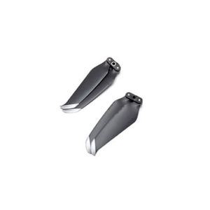
| Sensor | 1″ CMOS |
| Effective Pixels: 20M | |
| (Total 20.48M Pixels) | |
| Lens | FOV 75° 10.6 mm/29 mm |
| (35 mm format equivalent) | |
| f/2.8 – f/11 auto focus at 1 m – ∞ | |
| ISO Range | Video: |
| 100 – 3200 (Auto) | |
| 100 – 6400 (Manual) | |
| Photo: | |
| 100 – 3200 (Auto) | |
| 100- 12800 (Manual) | |
| Mechanical Shutter Speed | 8-1/2000 s |
| Electronic Shutter Speed | 8-1/8000 s |
| Image Size | 3:2 Aspect Ratio: 5472 × 3648 |
| 4:3 Aspect Ratio: 4864 × 3648 | |
| Support File Systems | FAT32 (≤32 GB); |
| exFAT (>32 GB) | |
| Photo | JPEG |
| Build-in Storage Capacity | emmc 5.1 32G |
| Supported SD Cards | Micro SD |
| Max Capacity: 128GB | |
| Write speed ≥15MB/s, | |
| Class 10 or UHS-1 rating required | |
| Max Working Voltage | 52.2 V (12S LiPo) |
| Max Working Current (Continuous) | 100A |
| Sensor | 1″ CMOS |
| Effective Pixels: 20M | |
| (Total 20.48M Pixels) | |
| Imaging method | Mechanical Shutter |
| + | |
| Global Reset Shutter | |
| ISO Range | Video: |
| 100 – 3200 (Auto) | |
| 100 – 6400 (Manual) | |
| Lens | FOV 75° 10.6 mm/29 mm |
| (35 mm format equivalent) | |
| f/2.8 – f/11 auto focus at 1 m – ∞ | |
| Image Size | 3:2 Aspect Ratio: 5472 × 3648 |
| 4:3 Aspect Ratio: 4864 × 3648 |
| Multispectral Sensors | 4 |
| Multispectral Bands | Green (550nm ± 15nm) |
| Red (660nm ± 15nm) | |
| Red edge (735nm ± 10nm) | |
| Near-infrared (790nm ± 15nm) | |
| Sensor Resolution | 1280 x 800 |
| Shutter | Global Shutter |
| Single Band FOV | DFOV 104° |
| HFOV 79° | |
| VFOV 57.6° | |
| Calibration | Automatic photosensitive radiation calibration |