


-Learn more, work smarter-
Effective aerial research needs to see the invisible. That’s why Mavic 3 Multispectral has two forms of vision. It combines an RGB camera with a multi-spectral camera to scan and analyse crop growth in absolute clarity. Managing agricultural production requires precision and data, and Mavic 3M offers both.


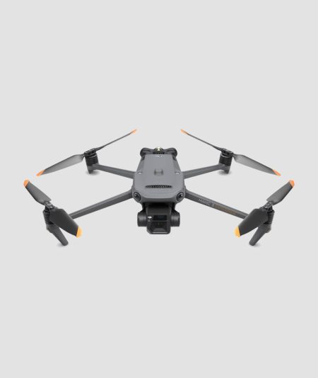
DJI Mavic 3M (EU) Multispectral Drone
Description
Features:
- Compact and portable, foldable for easy storage
- Multispectral camera, 4 × 5MP, G/R/RE/NIR
- RGB camera, 20 MP 4/3 CMOS, 20 MP, mechanical shutter
- Safe and stable, 360° omnidirectional obstacle avoidance, 15km transmission distance
- Accurate RTK tracking at centimetre level, absolute time synchronisation
- Efficient aerial topography, up to 200 acres per flight
Multispectral + RGB imaging system
Newly upgraded imaging system with a 20MP RGB camera and four 5MP multispectral cameras. It enables applications such as high-precision aerial surveying, crop growth monitoring and natural resource surveys.
RGB camera features
- 4/3 CMOS Image Sensor 20MP
- 1/2000s Faster mechanical shutter speed
- 0.7s High-speed range when RGB camera is used
Solar light sensor
The built-in sunlight sensor captures solar radiation and stores it in an image file, allowing light compensation of image data during 2D reconstruction. This results in more accurate NDVI results, as well as improved accuracy and consistency of data acquired over time.
RTK unit, Accurate images capturing every pixel
The flight control, camera and RTK module are synchronised in microseconds to accurately record the position of the imaging centre of each camera. This allows Mavic 3M to do high precision aerial topography without using ground control points (photostats-GCPs).
Efficient and reliable battery life
- Extremely long battery life
- 43 minutes flight duration
- A single flight can complete 200 acres of mapping work.
Fast charging
- Battery Charging Dispenser 100W High efficiency fast charging
- 88W fast charging aircraft
Stable signal, smooth image transmission
The O3 transmission incorporates two transmit signals and four receive signals to support extremely long transmission distances of 15 km.
360° omnidirectional obstacle detection, aerial terrain topography
The aircraft has multiple wide FOV vision sensors that accurately detect obstacles in all directions for omnidirectional obstacle avoidance. Aerial terrain mapping can be easily carried out on landscapes with steep slopes.
Applications
- Mapping in 3D
Mavic 3M allows aerial monitoring of crops, even in sloping fields. Together with DJI Terra or the DJI SmartFarm Platform, you can create high-resolution orchard maps, automatically measure trees, distinguish trees from other obstacles or objects, and create 3D flight paths for spray drones, making these operations safer and more efficient.
- Variable dose application guide
For fertilizing rice, regulating cotton growth and spraying fertilizer on potatoes, the Mavic 3M is used to capture multispectral images of crops. DJI Terra or the DJI SmartFarm platform can then generate NDVI maps and other vegetation indicators, capturing differences in a crop’s potential and creating recipe maps that allow spray drones to perform variable-dose spray applications. This allows you to reduce your costs, increase yields and protect the environment.
- Intelligent field localisation
Mavic 3M can perform automatic field tracking. Field scan images can be uploaded to the DJI SmartFarm platform in real time via the 4G network. It can detect anomalies, stress, weed pressure and more. It can also conduct intelligent analyses, such as cotton seedling identification and comparative yield analyses in rice fields, using artificial intelligence for information sharing & data analysis. Easy management of up to 700 acres of land by a single person.
- Environmental Monitoring and Natural Resources Research
The Mavic 3M can also be used in environmental and natural resource surveys, such as water enrichment monitoring, forest distribution surveys, urban green space surveys and more.
Proposed equipment configurations:
- For small plots, 1x aircraft with 1x battery (included in the basic version) is enough
- For plots between 1000-3000 acres, equip yourself with a 2nd battery
- For areas larger than 3000 acres, purchase the Battery Kit which includes 3X batteries and a battery charging hub.
Every Mavic 3M purchase comes with:
- Free use of DJI Terra (full suite) for 3 months for 1 device
- Free use of DJI SmartFarm Platform for 1 year for 1 device
- DJI Care 1 year
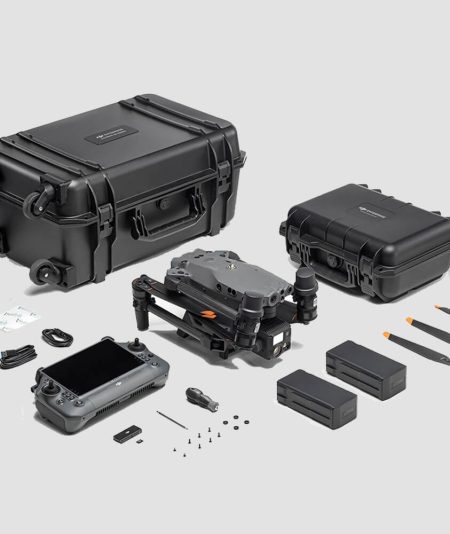
Included:
- Aircraft with RTK and microSD card installed
- Smart flight battery
- Remote control
- 3 extra pairs of propellers
- Charger
- Hard case
- Power & USB cables
Related products
-
 14.350,00 € χωρίς Φ.Π.Α.
With IP55 protection, the DJI Matrice 30T can easily handle harsh weather conditions and temperatures ranging from -20°C~50°C.
-
 3.790,00 € – 7.840,00 € χωρίς Φ.Π.Α.
The Mavic 3 Enterprise Series redefines the industry standard for small commercial drones. With a mechanical shutter, 56× zoom camera and RTK module for centimetre-level accuracy, the Mavic 3E takes mission mapping and efficiency to new heights.
-
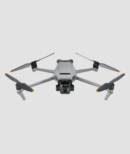 1.979,00 € χωρίς Φ.Π.Α.
Capture legendary content with a Hasselblad 4/3 CMOS camera and enjoy smooth flight with omnidirectional obstacle detection. Each upgrade to the DJI Mavic 3 sets a new benchmark for what aerial photography can be. Fly with Mavic 3 and discover imaging above all else.
-
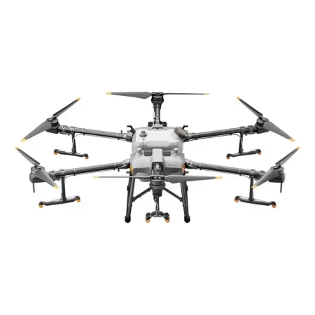
-A new flagship for digital agriculture-
With a 30-litre tank, the DJI Agras T30 takes aerial spraying performance to new heights. The new revolutionary design allows more efficient spraying, especially for fruit trees. Using DJI’s digital farming solutions, the T30 helps reduce fertilizer use and increase yields with effective best practices based on real data.The package (KIT) includes:
- DJI Agras T30 Drone x1
- DJI Agras T30 Intelligent Battery Station x1
- DJI Agras T30 Intelligent Flight Battery x3


