
Reach new frontiers!!!
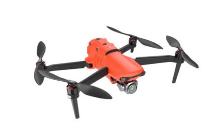
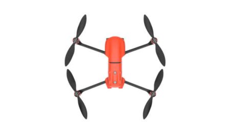
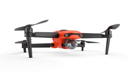
The EVO Max 4T brings powerful technologies and advanced autonomy to users. EVO Max 4T assesses complex environments to create real-time 3D flight paths for unparalleled obstacle avoidance.
 enEnglish


")
")
")
Reach new frontiers!!!
The EVO Max 4T brings powerful technologies and advanced autonomy to users. EVO Max 4T assesses complex environments to create real-time 3D flight paths for unparalleled obstacle avoidance.
Advanced sensors make it possible to fly in unavailable GPS areas and the incredible new thermal payload unlocks new scenarios for object recognition and tracking. With its foldable, weather-resistant design, the EVO Max 4T is as portable as it is capable.
Collects surrounding environmental data and plans 3D flight paths through complex environments such as mountains, forests, and buildings. Use cases include rapid 3D scene reconstruction, public safety overwatch, industrial inspection, and land surveying.
Advanced sensors allow the EVO Max 4T to navigate within hardened structures, underground, or in environments without GPS.
Based on Autel’s AI recognition technology, the EVO Max 4T can automatically identify and lock onto different types of targets such as heat sources, moving people, or vehicles and achieve high-altitude tracking and data collection for law enforcement.
EVO Max 4T is the only commercial drone that combines traditional binocular vision systems with millimeter wave radar technology. This allows the EVO Max 4T’s onboard Autel Autonomy Engine to perceive objects down to 0.5 inch, eliminating blind spots and enabling operation in low light or rainy conditions.
The EVO Max 4T uses advanced flight control modules and algorithms specially designed to counter RFI, EMI, and GPS spoofing. This enables the EVO Max 4T to fly confidently near power lines, critical structures, and in complex areas.
The EVO Max 4T can communicate seamlessly with other drones in the vicinity, unlike a traditional chain structure. If a single drone fails or exits unexpectedly, the entire system will independently self-organize and continue to relay critical information.
Multiple drones can be controlled autonomously by 1 pilot or by a group of pilots simultaneously with or without LTE coverage.
With A-Mesh, multiple aircrafts in the vicinity can act as relay points to greatly improve BVLOS operation effectiveness.

Autel EVO II Series – The World’s First 8K Foldable Consumer Drone!! The Autel EVO 2 Pro features a 6K camera with a 1-inch CMOS sensor and 29mm focal length optics (full-frame equivalent) with an adjustable aperture (f/2.8-f/11). The sensor offers a maximum resolution of 20MP (5,472 x 3,648 pixels) […]


See clearer with Sony’s new 20 megapixel 1-inch CMOS image sensor. The EVO II Pro V3 supports 6K video with stronger noise suppression and higher frame rates.

Autel EVO II Series – Three new cameras, the Autel EVO II series has a new drone body available in three different versions with three different camera modules: The Autel EVO II features an 8K camera with a 1/2-inch CMOS sensor. It offers a maximum resolution of 48MP (8,000 x […]

APPS – Applications
| iOS | Autel Explorer |
| Android | Autel Explorer |
Storage
| SD storage | Standard: 32 GB, Maximum support: 256GB (UHS-3 rating required) |
| Internal storage | 8GB |