


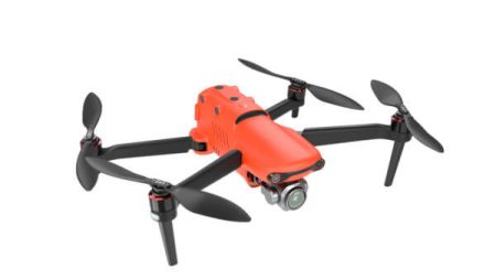
Upgrade your next mapping project with the most compact and highly accurate low-altitude mapping solution with the Phantom 4 RTK.

")
")
Phantom 4 RTK Combo
4.595,00 € χωρίς Φ.Π.Α.
Description
DJI has rethought its drone technology from the ground-up, revolutionizing its systems to achieve a new standard for drone accuracy – offering Phantom 4 RTK customers centimeter-accurate data while requiring fewer ground control points.
The Phantom 4RTK is equipped with the C4K camera, with a 1”CMOS sensor and an 8 element lens with a FOV of 84 degrees, for professional shooting. Captures video in H.264 or H.265 and C4K resolution 4096×2160 up to 60fps for great results. At the same time, 20MP photos with manual ISO 100-12800 and electric (8-1/2000s) and mechanical (1/2000 – 1/8000s) shutter will be exactly as you imagine them.
Equipped with 5 obstacle detection and 4 obstacle avoidance sensors, it can detect and avoid obstacles up to 30 meters away, even when flying at speeds of up to 50k/h. With sensors mounted on the front, back and sides of the drone, the Phantom 4 RTK can hover in space even without GPS. And with the Flight Autonomy system it creates a 3D map within which it can move with extreme comfort.
A new RTK module is integrated directly into the Phantom 4 RTK, providing real-time, centimeter-level positioning data for improved absolute accuracy on image metadata. Just below the RTK receiver is an additional GNSS, installed to maintain flight stability in areas with low signal strength, such as cities. By combining both elements, the Phantom 4 RTK is able to optimise flight safety while ensuring the most accurate data for complex measurement, mapping and inspection workflows.
Fit the Phantom 4 RTK to any workflow, with the ability to connect this positioning system to the D-RTK 2 High Precision GNSS Mobile Station, or NTRIP (Network Transport of RTCM via Internet Protocol) using a 4G dongle or WiFi hotspot.
Gather Accurate Data with TimeSync
To take full advantage of the Phantom 4 RTK’s positioning modules, the new TimeSync system was created to continually align the flight controller, camera and RTK module. Additionally, TimeSync ensures each photo uses the most accurate metadata and fixes the positioning data to optical center of the lens – optimizing the results from photogrammetric methods and letting the image achieve centimeter-level positioning data.
Flight Planning Application
A new GS RTK app allows pilots to intelligently control the Phantom 4 RTK, with two design modes – Photogrammetry and Waypoint Flight – along with a more traditional flight mode. Programming modes allow pilots to select the drone’s flight path while adjusting the overlap rate, altitude, speed, camera parameters and more, providing an automated mapping or inspection workflow. The GS RTK application has been built with users in mind and therefore has a range of features designed for specific mapping or inspection workflows. The app has the ability to instantly upload KML files for in-office flight planning, a new priority shooting mode to keep exposure consistent across all photos and a wind alert to warn pilots of any adverse conditions.
Related products
-

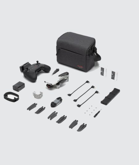
An improved high-quality imaging system, upgraded 9.3 miles image transmission range, and additional modular accessories help you meet a variety of use cases including inspection, search and rescue, situation overwatch, and more.
-
 799,00 € χωρίς Φ.Π.Α.
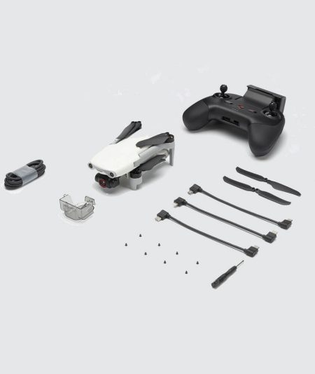
EVO Nano+ is packed a 1/1.28-inch(0.8-inch) CMOS sensor capable of 50 MP photos.
-
 799,00 € χωρίς Φ.Π.Α.
EVO Nano+ is packed a 1/1.28-inch(0.8-inch) CMOS sensor capable of 50 MP photos.
-
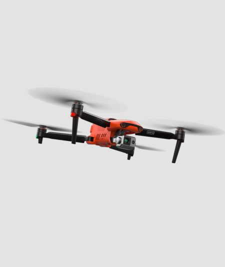
Autel EVO II Series – The World’s First 8K Foldable Consumer Drone!! The Autel EVO 2 Pro features a 6K camera with a 1-inch CMOS sensor and 29mm focal length optics (full-frame equivalent) with an adjustable aperture (f/2.8-f/11). The sensor offers a maximum resolution of 20MP (5,472 x 3,648 pixels) […]

